
Paintings, Prints & Drawings — 1746; 1915
Rocque's Map of London, 1746
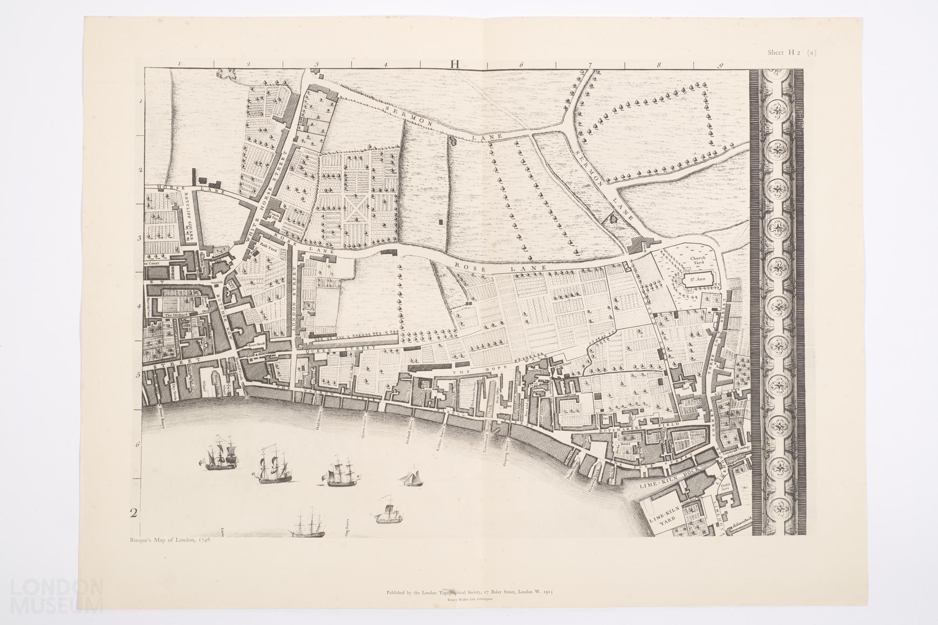
Single-sided map titled: Rocque's Map of London, 1746, published 1915. Map shows Rose Lane, Lime Kiln Dock, St. Ann's Church. Sheet H2 (A). Original map was published by John Pine and John Tinney according to an Act of Parliament.
- Category:
- Paintings, Prints & Drawings
- Object ID:
- 34.257/610
- Object name:
- Rocque's Map of London, 1746
- Object type:
- Artist/Maker:
- London Topographical Society
- Related people:
- Related events:
- Related places:
- Production date:
- 1746; 1915
- Material:
paper, ink
- Measurements/duration:
- H 431 mm, W 571 mm
- Part of:
- —
- On display:
- —
- Record quality:
- 60%
- Part of this object:
- —
- Owner Status & Credit:
Permanent collection
- Copyright holder:
digital image © London Museum
- Image credit:
- —
- Creative commons usage:
- CC BY-NC 4.0
- License this image:
To license this image for commercial use, please contact the London Museum Picture Library.
Tags
Download image file
You are welcome to download and use this image for free under Creative Commons Licence CC BY-NC 4.0.
Credit: London Museum
To licence this image for commercial use please contact the London Museum Picture Library