
Victorian photographs of Barnet & Enfield
In around 1870, photographer William Atwood captured life in the rural villages around present-day Barnet and Enfield. His photographs are a snapshot of long-gone peace and quiet, full of fields, woodland, winding lanes and quaint churchyards.
Barnet & Enfield
Around 1870

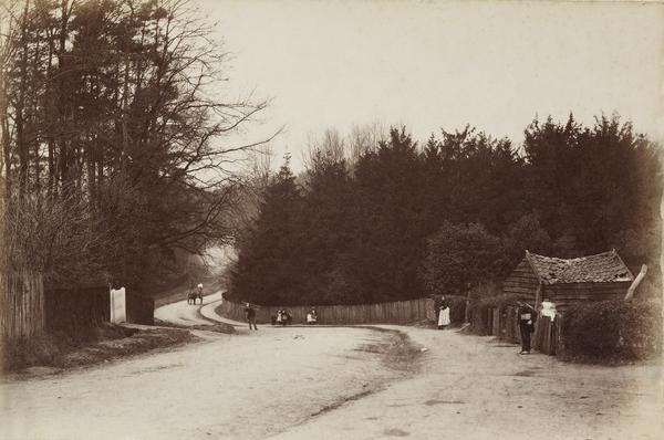
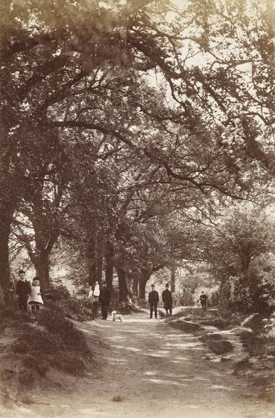
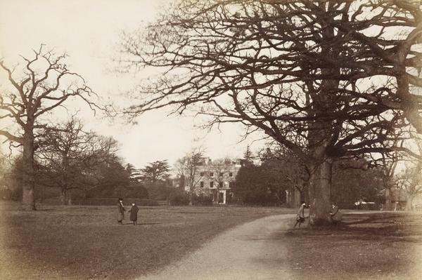
Blind Lane, Osidge
This winding lane is now called Osidge Lane, and what were once fields are now houses and shops. Osidge was a rural estate centred on a manor house which, from 1893, was the home of Thomas Lipton, founder of Lipton Tea. After he died in 1931, the house was converted into the Sir Thomas Lipton Memorial Home for retired nurses.

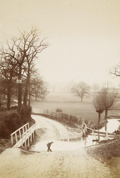
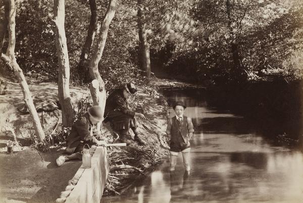
Paddling in Blind Lane Brook, Osidge
Blind Lane Brook is now called Pymmes Brook. A tributary of the River Lea, the brook cuts across Osidge Lane and down through Brunswick Park and Arnos Park, before roughly following the North Circular to Tottenham.

Southgate Green
Southgate remained a rural idyll well into the 20th century, surrounded by wood and farmland. Many of the houses and shops around the green date back to the 1700s. Today, you’ll also find a replica of the ‘Southgate stocks’ on the green, marking where villagers would once have been punished for things like gambling and petty theft.
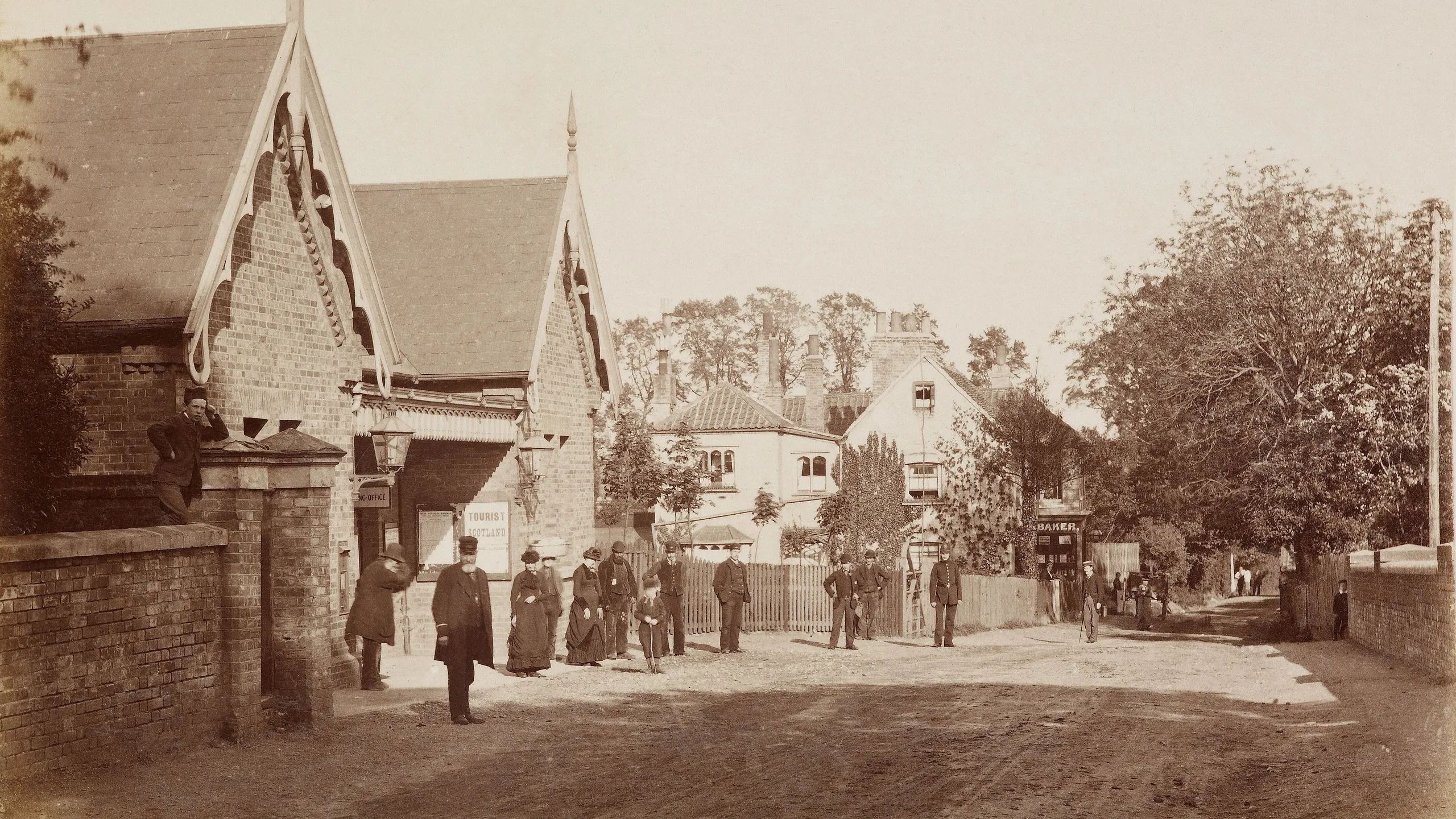
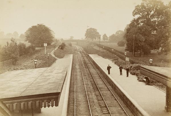
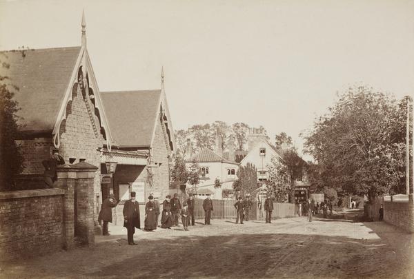
Winchmore Hill Station
Winchmore Hill Station opened in 1871 on the Great Northern Railway line that first connected Wood Green to Enfield. But this new railway didn’t initially bring the expansion and development you might expect. The main landowners resisted selling their land and, like Southgate, Winchmore Hill kept its village character until the early 1900s.

Winchmore Hill Green
Here, you can see children, horses and carts on Winchmore Hill Green. In the late 1800s, the terraces of shops and houses we see today were built around the green. It still looks like a historic village centre today, having become a conservation area in 1968.

St Mary the Virgin church, Hadley
Hadley is an ancient Barnet village, and its St Mary the Virgin church was first built in the 1100s. Much of the building you see in this picture – and today – was built at the end of the 1400s. One of Hadley’s claims to fame is that it was the main site of the Battle of Barnet of 1471, a key battle in the English Wars of the Roses (1455–1485).
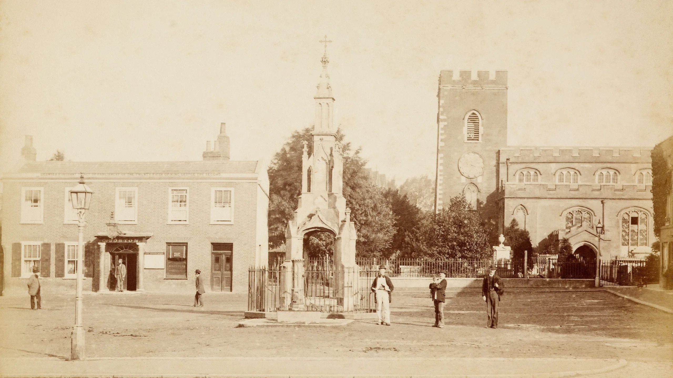
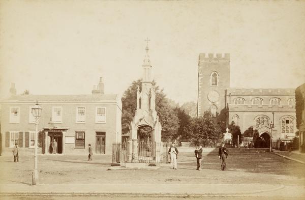
Market Place, Enfield
Markets have been held in this part of Enfield since 1303, when King Edward I granted the right to run a Monday market. This photograph was taken on a non-market day, so you can see the 14th-century St Andrew’s church on the right and the King’s Head pub on the left. The Gothic-style market cross now sits in the grounds of Enfield’s Myddleton House.

Colney Hatch Lane in the snow
Colney Hatch Lane is now a main road connecting Friern Barnet above the North Circular to Muswell Hill below it. The area was mainly rural until after the First World War ended in 1918, and land east of Colney Hatch Lane was still being farmed in 1902.
Tags
-
Photography
-
-
-
-
-
-
Photography
-
-