Photographs of Stratford before the 2012 Olympics
In the early to mid-2000s, Mike Seaborne photographed the pocket of east London set to be redeveloped into the London 2012 Olympic Park. Spanning waterways and railways, warehouses and housing estates, these photos are a snapshot of an area on the precipice of immense change.
Newham
2005–2007

View of Clays Lane and the Olympics Site
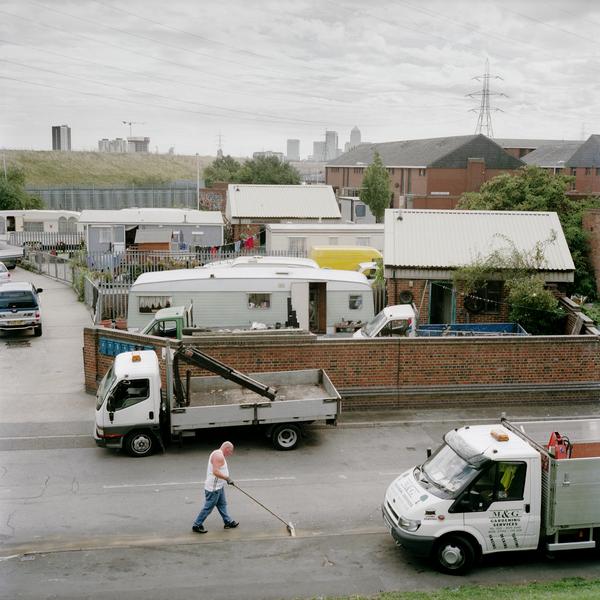
This photo was taken from the roof of Templar’s House, a tower block of former student housing. Templar’s House, plus the Clays Lane estate and travellers’ site in the foreground, were bought by the London Development Agency to make way for the Olympic Park.

The Clays Lane Co-operative Housing Estate
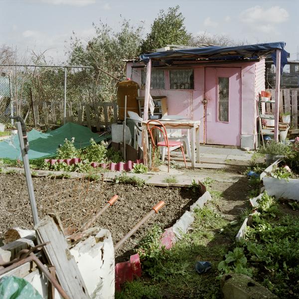
Clays Lane was the largest purpose-built housing co-operative in the UK. Founded in 1977, the estate provided low-rent housing to a close-knit community of around 450 people. They were evicted and relocated when the estate closed in July 2007.

Travellers' site, Temple Mills
Like the residents of the Clays Lane Estate on the right of this image, the travellers living on the site to the left were also relocated. Families had been living there since the site opened in 1971. You can see Templar’s House in the background.

Industry along the City Mill River
Across the City Mill River sat Banner Chemical's chemical storage and distribution depot. Established in 1860, the company was part of the area’s long tradition of chemical works since the 19th century. It moved to Middlesbrough after the Stratford site closed.

Marshgate Lane car scrapyard
A car scrapyard in the snow. This photograph shows a view looking north-west from the railway bank by the Greenway.

Eastway Cycle Circuit, Temple Mills
Established in 1975, the Eastway Cycle Circuit ran through a nature reserve and hosted competitions for road riders, mountain bikers and cyclo-cross racers. Despite protests, it closed in 2006 and was redeveloped as the Olympic VeloPark.

Marked trees among the snow
Here, two trees are marked with red crosses. They were part of the natural and unmanaged area of ground between the Lea Navigation and Marshgate Lane.

A glimpse of the lost Pudding Mill River
The junction of the Old River Lea and a lost east London landmark, the Pudding Mill River. It was once a tributary of the River Lea and took its name from an old water mill. But Pudding Mill was filled in so that the Olympic Stadium could be built.


