Photographing London after dark
In the late 1980s and 1990s, Alan Delaney set out at night to photograph London’s dark corners and bright lights, its unusual urban shapes and beguiling atmosphere.
Across London
1980s & 1990s

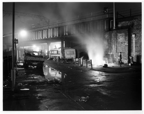
Unofficial Travellers’ site, London Fields
Since the 20th century, urbanisation and a lack of support from local authorities have combined to greatly reduce the number of legal sites for Travellers and Gypsies in London. Many have been forced to abandon their nomadic traditions. A 2008 study put the London-wide population of Gypsies and Travellers at 17,664. A 2011 study estimated that there were 400–500 in Hackney.

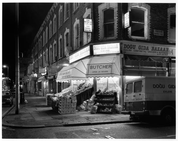
Dogu Gida Bazaar, Stoke Newington
The Dogu Gida Bazaar, a Turkish grocer and butcher, on Stoke Newington Road, Hackney, 1994. Hackney has been home to a Turkish-speaking community since the 1930s, when Turkish Cypriots began to settle in north and east London.

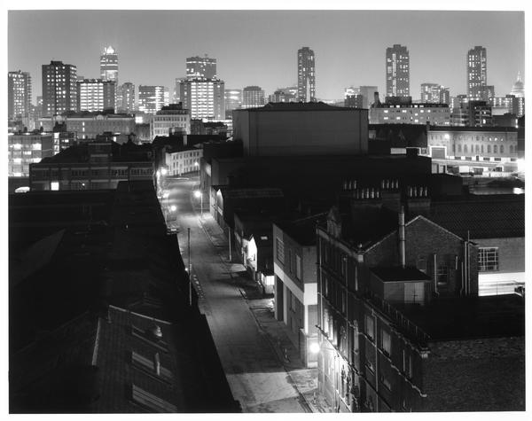
Wharf Road, Islington
This view from Islington towards the City of London from 1985 shows the three Barbican towers, but is missing most of the skyscrapers you’d see today. Wharf Road splits the Wenlock and City Road Basins, built in the 1820s to handle goods transported along Regent’s Canal.

Ridley Road Bagel Shop, Dalston
Ridley Road, shown here in 1994, is still home to a busy market. In the early 20th century it was at the centre of London's Jewish community. It later became more diverse as South Asian, Greek, Turkish and Caribbean communities settled in the area.

King’s Cross Station
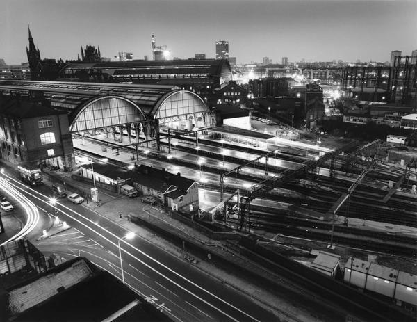
This photo shows York Way, King’s Cross Station and, in the background, St Pancras Station. King’s Cross train station opened in 1852, with St Pancras following in 1868.

Goods Way, King’s Cross
Large 19th-century gas holders like these dotted the landscape of King’s Cross for over 150 years. A major redevelopment of the industrial area alongside the Regent’s Canal began in 2008. Some of the gas holders were reused as architectural features – one rises from a park, while three others contain apartment buildings.

Canary Wharf
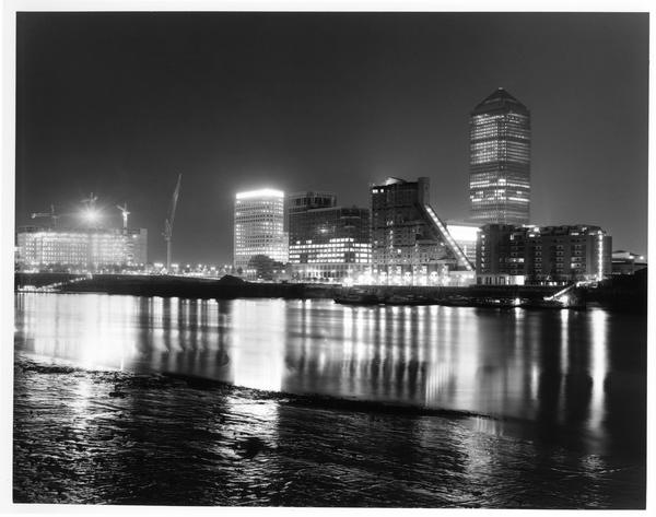
This view across the river from Rotherhithe was captured in 1991, while the Canary Wharf financial district was still taking shape. One Canada Square, its most iconic tower, can be seen on the right-hand side. Redevelopment of the former docklands on the Isle of Dogs began in the 1980s, bringing a very different type of worker to this part of east London.
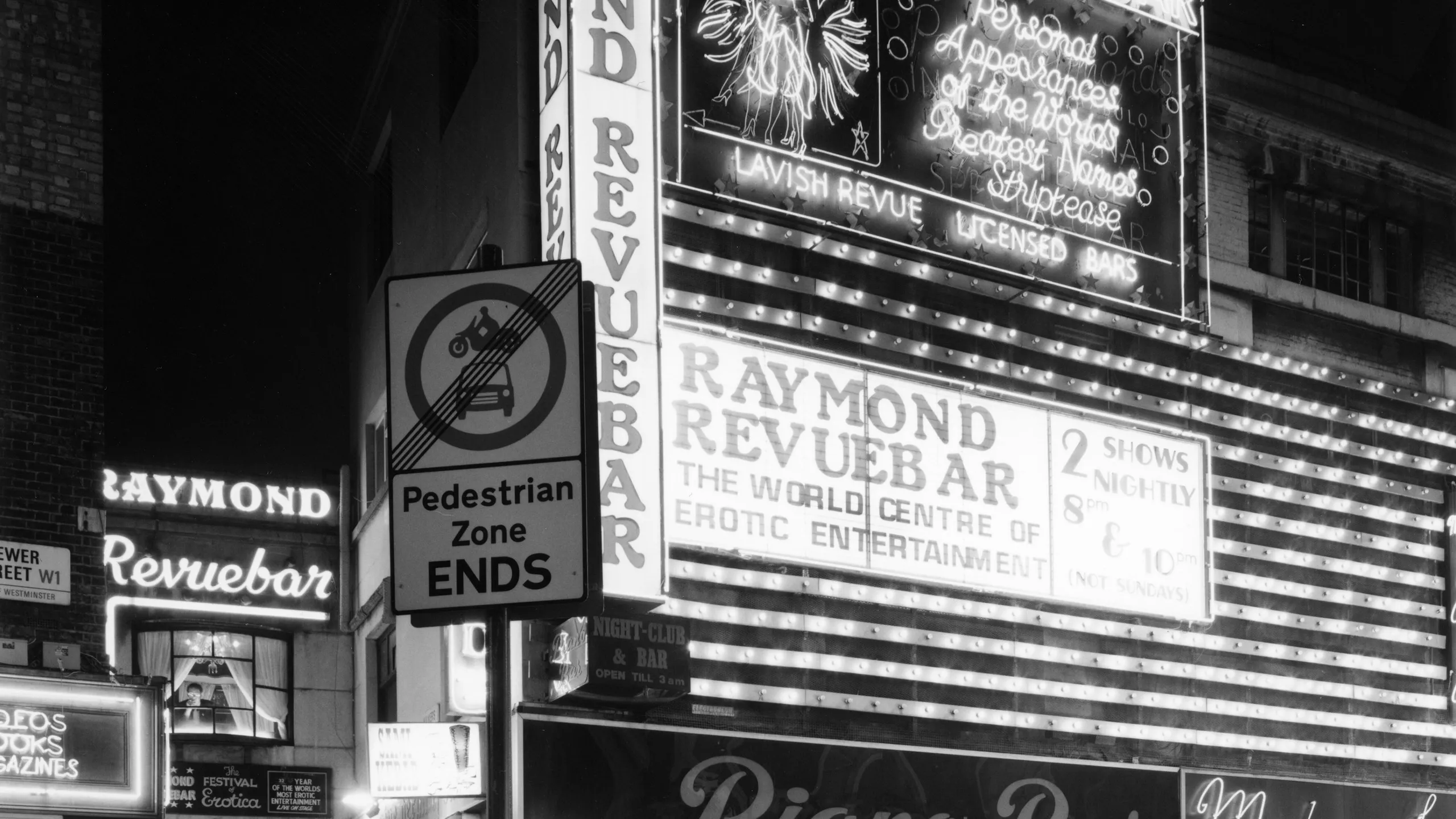
Brewer Street, Soho
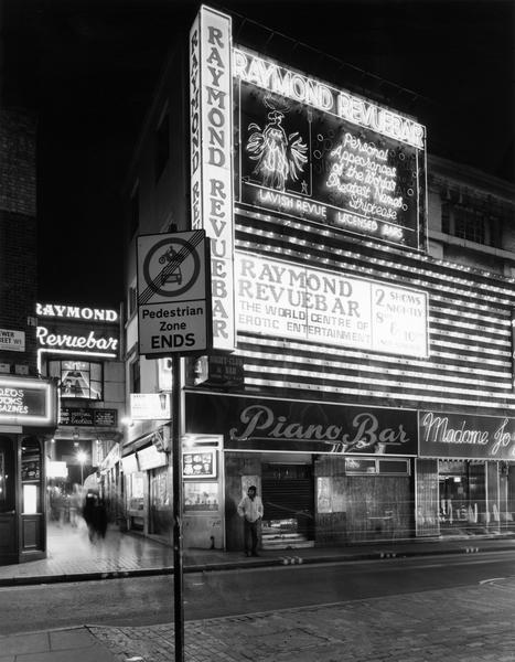
The Raymond Revue Bar, photographed here in 1993, opened as a strip club in 1958. Soho has long been a place to go for restaurants and entertainment, and it was once London’s red light district. After closing in 2004, the Raymond Revue Bar became a gay bar and cabaret venue called Much2Much, changing its name to Soho Revue Bar in 2006. The Soho Revue Bar closed in 2009.

Annette Crescent, Islington
These 23 Grade II-listed houses on Essex Road were built in 1819 on land owned by Thomas James Annett. No, it’s not a typo – Islington Council later changed the spelling from ‘Annett’ to ‘Annette’. The houses are still there today, although they’ve now been divided into studio apartments.
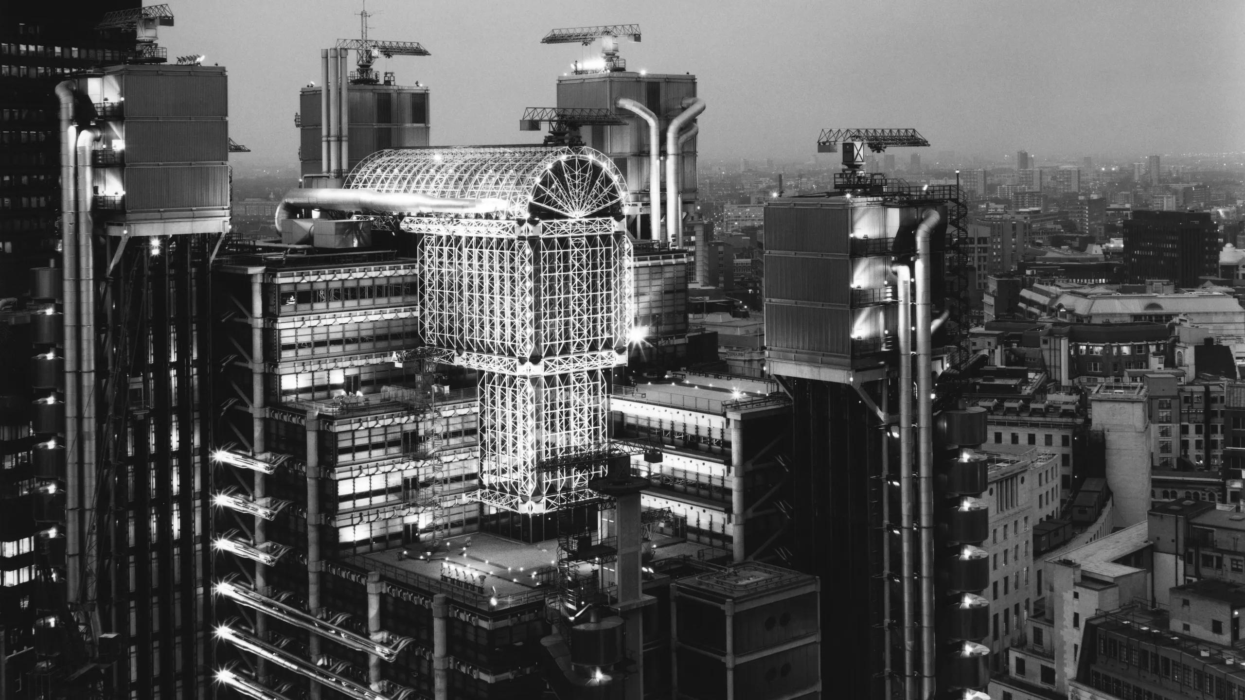
Lloyd’s Building, City of London
The futuristic Lloyd’s Building on Lime Street was built to house London’s historic insurance market. Opened in 1986, it was designed by the Richard Rogers Partnership. The elevators, staircases and pipes were placed on the outside of the building, giving it its alien appearance while leaving a roomier space inside.
